Tidal Survey

Our Tidal Survey services provide accurate and reliable water level measurements essential for elevation referencing, marine construction, and offshore asset planning. Designed for use in coastal, port, and offshore environments, we deploy advanced technologies to capture real-time and long-term tidal behaviour with high precision.
Our Capabilities Include
Offshore Platform Elevation Determination
Relative to chart datums such as LAT, MSL, and HAT
Mean Sea Level (MSL) Calculation
For long-term coastal planning and engineering design reference
Lowest Astronomical Tide (LAT) Determination
For safe clearance, dredging, and vessel navigation
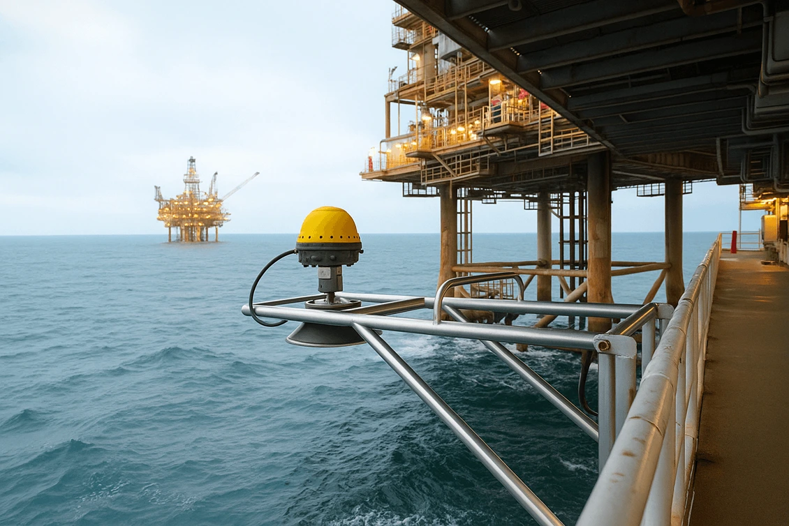
Real-time Tidal Monitoring
Using radar level sensors and pressure transducers with data loggers
Tidal Station Deployment
For both short-term project-based studies and long-term observatories
Post-processed Tidal Data Correction
For bathymetric surveys and elevation model adjustments
Advanced Monitoring Technologies
Radar Level Sensors
Non-contact, ideal for offshore and high-turbulence conditions
Pressure Transducers & Data Loggers
High-accuracy subsurface water level sensing
Applications
Offshore Platform & Structure Height Verification
Port Development & Dredging Operations
Bridge & Causeway Design Support
Bathymetric & Hydrographic Correlation
Coastal Resilience & Sea Level Trend Analysis
Expert Processing & Analysis
All collected data is processed by experienced hydrographic surveyors and geodetic engineers, ensuring:
Accurate Transformation to Local or Global Datums
Compatibility with GNSS-based Elevation Models
Alignment with IHO and IAG Guidelines
Our Tidal Survey services are critical for offshore elevation surveys, marine asset integration, and safe approach design— enabling confidence in your structural planning, navigational safety, and compliance requirements.
Ready to Start Your Project?
Contact our experts today for a comprehensive consultation and custom solution tailored to your needs.
Get in Touch